
Mine geology and resources
GMT integrates resource geology, structural interpretation and rock mass understanding into a synergistic framework of orebody knowledge that supports clear definition of the deposit and confident decisions from exploration to production.
Exploration services
Exploration programs
GMT designs and implements exploration programs that define mineralisation efficiently and reduce early-stage project risk. Our work integrates drilling strategies, logging protocols, sampling and QA/QC to build reliable datasets that support confident geological interpretation. Structural mapping, remote sensing and geochemical or geophysical datasets are combined to refine targets and guide investment into the most prospective areas. This approach supports discovery, accelerates development pathways and ensures exploration decisions are based on defensible geological evidence.
Target refinement. Integration of geological, structural and geochemical inputs to identify and prioritise prospective targets.
Program design. Development of drilling, logging and sampling strategies that maximise data quality at minimum cost.
Data confidence. Implementation of QA/QC systems to ensure reliable datasets for modelling and evaluation.
Geological modelling
3D geological modelling
GMT constructs detailed 3D geological models that capture lithology, structure, alteration and mineralisation domains. Models integrate drillhole data, mapping, geophysical surveys and structural interpretation to establish a robust framework for resource estimation and mine design. Our expertise in structural geology and fracture modelling enables models that reflect true orebody geometry and geotechnical behaviour. Models are continuously updated as new data emerges, supporting adaptive planning and reliable technical evaluations across the project lifecycle.
Domain definition. Construction of lithological, structural and mineralisation domains that control resource distribution and geotechnical behaviour.
Data integration. Combination of drillholes, mapping and geophysical datasets into coherent, validated 3D models.
Model updating. Continuous refinement of models as new data is collected during exploration or mining.
Resource confidence
Resource estimation
GMT prepares mineral resource estimates that meet international reporting standards and reflect geological complexity with practical mining considerations. Estimation workflows incorporate geostatistics, validation checks and classification to JORC, NI 43-101 or equivalent codes. Our Qualified Persons can prepare or audit resource statements for public disclosure, ensuring technical robustness and defensible results. This provides stakeholders with clear understanding of deposit size, grade variability and confidence levels to support project valuation and development decisions.
Estimation workflows. Application of geostatistical techniques to generate resource models aligned with deposit style and data quality.
Compliance assurance. Classification and reporting aligned with international codes such as JORC and NI 43-101.
Independent validation. Review and verification of resource estimates to confirm reliability and support disclosure.

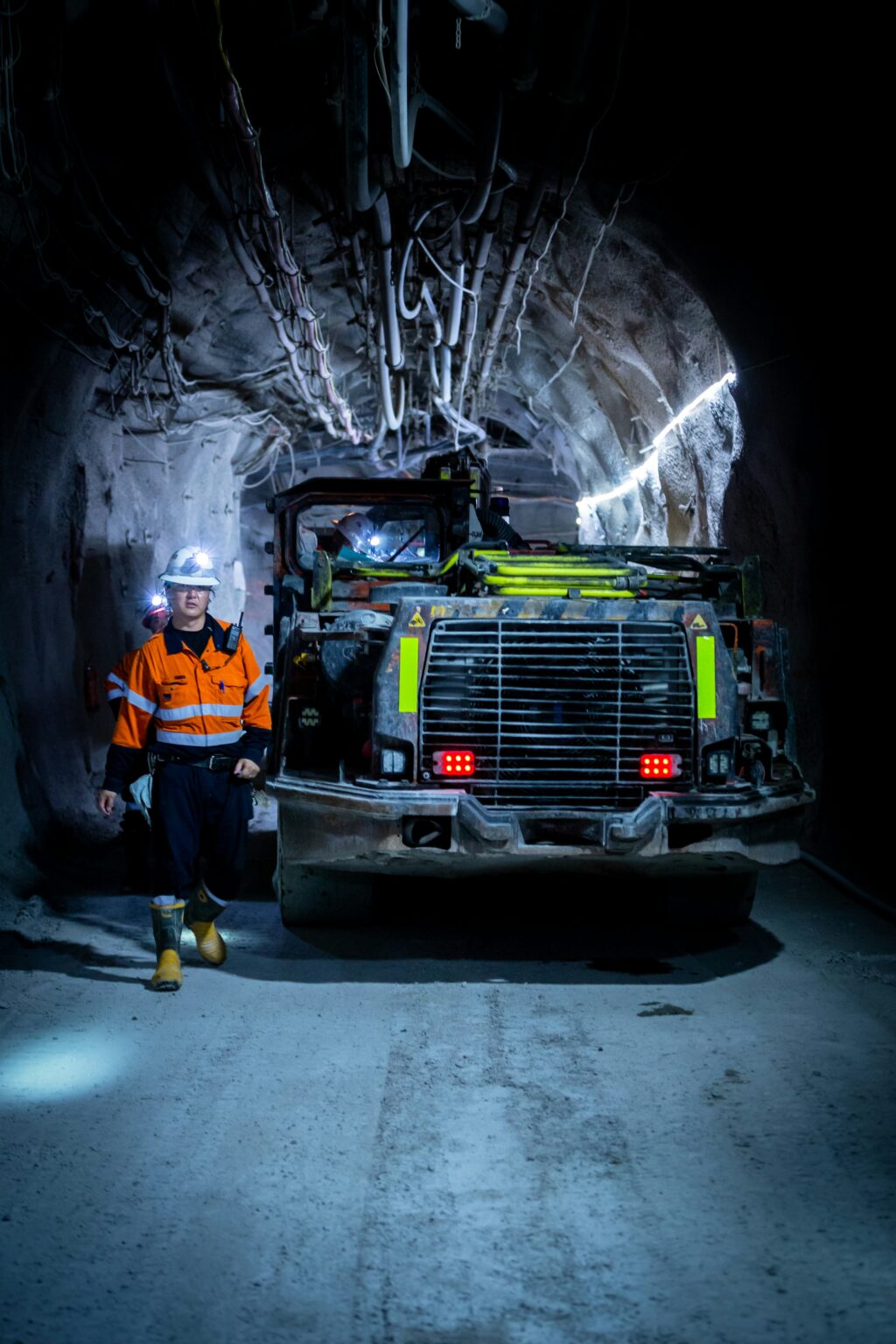
Operational geology
Grade control
GMT supports operating mines with grade control approaches that improve ore recovery, reduce dilution and ensure consistent reconciliation. Work includes short-term geological modelling, ore–waste definition, sampling strategies and blending plans suited to production needs. Reconciliation of mined grades against model predictions identifies sources of variance and drives continuous improvement. This integration of geological understanding and operational requirements ensures reliable feed quality and maximises the economic performance of the mine.
Ore definition. Short-term modelling and delineation of ore and waste to guide accurate production decisions.
Sampling strategy. Development of sampling, assaying and blending procedures that support grade consistency.
Reconciliation analysis. Investigation of variances between predicted and actual performance to improve future accuracy.
Orebody framework
Structural and geotechnical geology
GMT characterises structural controls on rock mass behaviour to inform both resource modelling and geotechnical design. Work includes oriented core logging, televiewer interpretation and mapping of pit walls or underground openings. Structural domains and fracture networks are defined to support excavation design for both open pit and underground mining. By integrating geological and geotechnical insights, we help predict hazards and ensure designs reflect the true structural setting of the orebody.
Structural definition. Characterisation of fault, fracture and fabric systems that influence orebody geometry and ground behaviour.
Geotechnical linkage. Integration of structural data into slope design, underground layouts and ground control assessments. Excavation interaction analysis. Evaluation of how mine-scale structures, geotechnical rock mass domains and structural controls influence open pit and underground excavation performance.
Ready to build with confidence?
Talk to our experts.